What Is a Drone 3D Model?
A drone 3D model is essentially a digital representation of a physical object or space, created by processing aerial images captured by drones. This process, known as aerial photogrammetry, involves stitching together multiple overlapping images to form a precise 3D model. These models are invaluable tools for industries that require detailed visualizations of landscapes, structures, and other environments.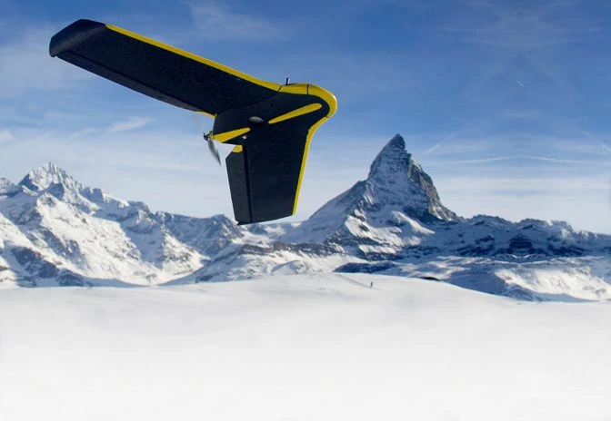
Why Drones Are Ideal for Aerial Photogrammetry
Drones offer several advantages over traditional methods like manned aircraft. They are far more cost-effective and easier to deploy, making them accessible to a wider range of users. Additionally, drones are equipped with advanced features like geotagging, which automatically embeds geographic coordinates into each image. This embedded data—comprising altitude, longitude, and latitude—is crucial for creating highly accurate 3D models.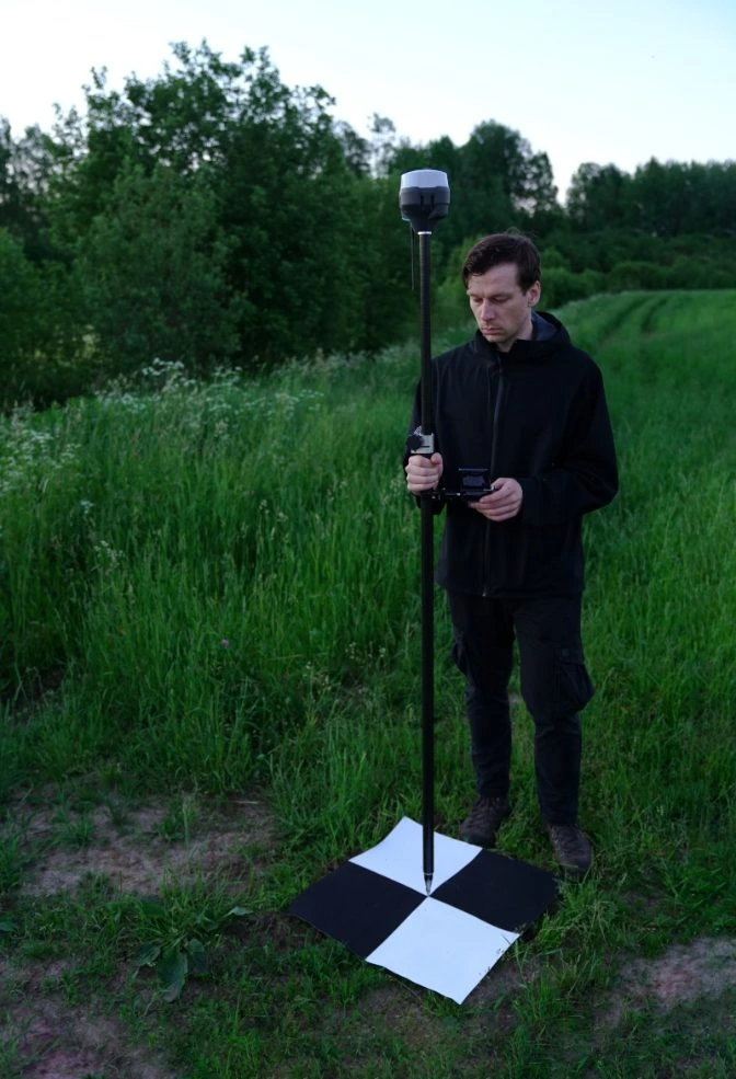
Steps to Creating a Drone 3D Model
To produce a drone 3D model, you'll need a robust dataset. Here’s how to gather the necessary data: 1. **Choose a High-Quality Drone**: Opt for a drone like the SenseFly eBee Classic, designed specifically for aerial surveys. 2. **Set Ground Control Points (GCPs)**: Place GCPs—black-and-white markers—with known coordinates around your target area. These serve as reference points, enhancing the accuracy of your model. 3. **Configure Your Drone**: Ensure your drone is calibrated correctly and programmed for automated flights. Check battery life, storage capacity, and camera settings. 4. **Conduct Surveys Under Optimal Conditions**: Choose clear weather to avoid disruptions and ensure high-quality imagery. 5. **Process Data with Software**: Use specialized software to convert collected images into 3D models. Platforms like Pix4Dmapper simplify this process.Data Considerations for Accurate Models
For effective aerial photogrammetry, every image should overlap by 60%-70%. The ideal flying height varies depending on the angle of the camera—typically between 150ft and 200ft for vertical shots. Adjusting the camera angle helps capture comprehensive views of the subject.Applications Across Industries
Drone 3D models find applications across diverse sectors due to their precision and versatility: - **Agriculture**: Farmers utilize these models to generate NDVI maps, aiding in crop health monitoring. - **Architecture & Engineering**: Professionals rely on 3D models for project planning and securing funding. - **Construction**: Monitoring progress and conducting inspections are streamlined through drone models. - **Inspections**: Safety and efficiency are boosted when inspecting assets remotely. - **Surveying**: Historical landscape records are maintained using drone data. - **Energy**: Companies leverage these models for maintaining complex infrastructures safely. - **Public Safety**: Crime scene mapping and disaster assessments benefit from drone-generated models. - **Real Estate**: Marketing properties becomes easier with immersive 3D presentations.The Future of Drone 3D Modeling
Technological advancements continue to enhance drone capabilities. Innovations like the Elios 3, featuring modular payloads including LiDAR sensors, allow real-time 3D mapping indoors. Such technologies empower inspectors to identify issues promptly and maintain comprehensive asset histories.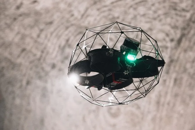
YK series oscillating granulator is mainly consisted of drive motor, feeding hopper, rotor, sieve and discharging chute. Wet mixtures of powders or big granules/agglomerates are fed into the granulating chamber via feeding hopper. The oscillating motion of rotor presses the material through the sieve to get required size of granules. The finished granules is discharged into the barrel via the discharging chute.
Oscillating Granulator,Swing Granulator,Pesticides Oscillating Granulator,Detergent Swing Granulator
Changzhou Bole Tech Co.,Ltd , https://www.boledrying.com